
1450
Wilkes Street
One of the original fourteen national cemeteries established in 1862, interring Union dead from the Civil War, including United States Colored Troops reinterred from L’Ouverture Hospital.
- 1862
- Extant
Place narrative
The Alexandria National Cemetery was established in 1862 on a four-acre tract at Wilkes and Payne streets, one of the original fourteen national cemeteries created under the July 17, 1862 act of Congress that authorized military cemeteries for Union dead [1] NARA Civil War records Government record . Burials began immediately; the cemetery grew to contain roughly 3,500 interments by the end of the war.
Following the December 1864 petition of Black soldiers at 219 South Payne Street 219 South Payne Street Union Army hospital established in February 1864 for U.S. Colored Troops and Black civilian refugees in occupied Alexandria. Named for Toussaint Louverture, the Haitian … , United States Colored Troops who had been buried in the segregated Freedmen’s Cemetery were reinterred in the national cemetery in 1865 and 1866 [2] Pippenger, Alexandria Death Records Book . Their graves are marked with the standard government-issue headstones used throughout the national cemetery system.
Timeline
3 chronological entries across 2 eras.
Gallery
Historical-style placeholder of Alexandria National Cemetery, c. 1864. Seed placeholder — KingSt.com, 2026. To be replaced with archival photograph. 
Secondary placeholder view of Alexandria National Cemetery. Seed placeholder — KingSt.com, 2026. To be replaced with archival photograph.
Connected
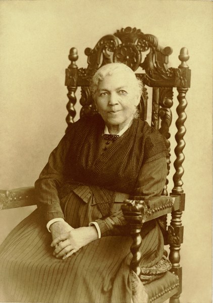
Harriet Jacobs
b. 1813 · d. 1897
Formerly enslaved author of Incidents in the Life of a Slave Girl (1861) who, with her daughter Louisa, worked among formerly enslaved people living in and around Union-occupied …
Visitor notable · Cemetery · %!d(float64=1864)–%!d(float64=1866)
Freedmen of the Contrabands Camp
founded 1861
Collective entity representing the several thousand formerly enslaved people who fled to Union-occupied Alexandria during the Civil War, settling in camps at Shuter's Hill, around …
Resident · Cemetery · %!d(float64=1865)–%!d(float64=1866)
Nearby in time
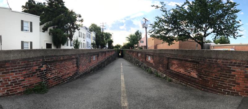
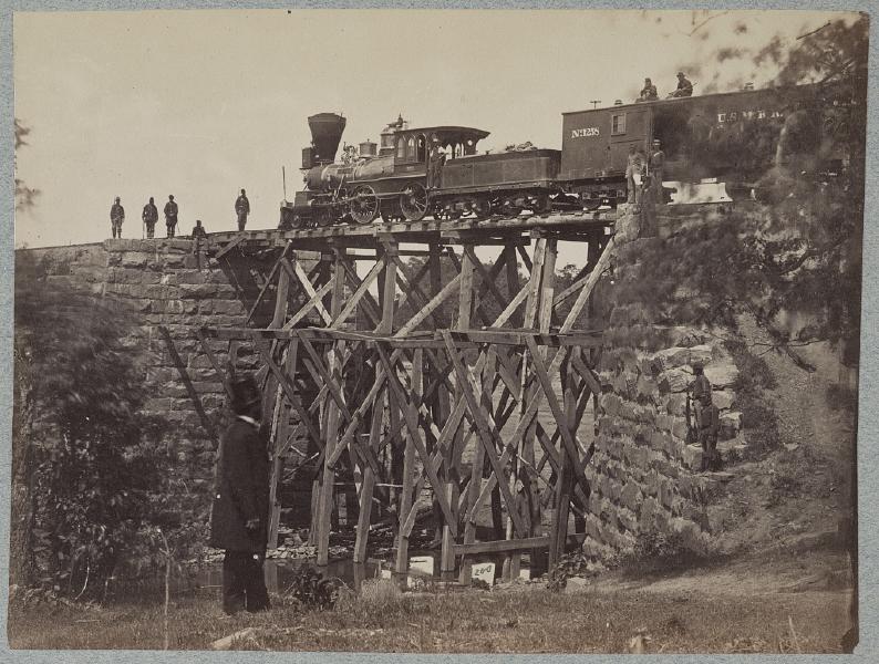
Wilkes Street Tunnel from the western approach, July 2017 — the brick-arched railroad tunnel cut beneath Wilkes Street in the early 1850s for the Orange & Alexandria Railroad to reach the Potomac wharves, today an Old Town pedestrian and bicycle passage. © KingSt.com, July 2017 Wilkes Street (between South Royal and South Lee)
Brick-arched railroad tunnel carved beneath Wilkes Street in the early 1850s for the Orange & Alexandria Railroad to reach the city's …
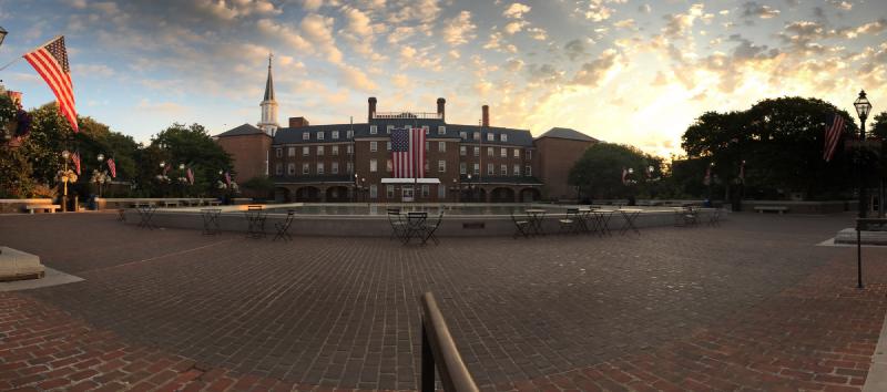
Market Square at sunrise, July 2017 — the city's eighteenth-century public square in its weekday-morning calm, framed by City Hall and the Fourth-of-July flags hung along the lamp posts. © KingSt.com, July 2017 301 King Street
Public square at 301 King Street fronting Alexandria City Hall — site of an open-air farmers market continuously operated since 1753, the …
107 South Alfred Street 107 South Alfred Street
1855 Italianate firehouse at 107 South Alfred Street, home of the Friendship Fire Company — founded 1774, the oldest volunteer fire company …
Bridge on Orange & Alexandria Railroad · Library of Congress, Prints & Photographs Division · http://www.loc.gov/item/2012649966/ Jamieson Avenue at Hooff's Run
1851 stone arch railroad bridge, in continuous use since the eve of the Civil War. NRHP-listed 2003.
Nearby in space
Bridge on Orange & Alexandria Railroad · Library of Congress, Prints & Photographs Division · http://www.loc.gov/item/2012649966/ Jamieson Avenue at Hooff's Run
1851 stone arch railroad bridge, in continuous use since the eve of the Civil War. NRHP-listed 2003.
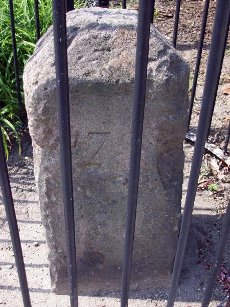
Bruce Andersen from Washington, DC · via Wikimedia Commons · CC BY-SA 2.0 1220 Wilkes Street
Sandstone boundary marker placed 1791 to mark the southwest corner of the original District of Columbia diamond. NRHP-listed 1991.
APK · via Wikimedia Commons · CC BY-SA 4.0 1707 Duke Street
Antebellum jail compound operated by slave trader Joseph Bruin from the 1840s through emancipation. NRHP-listed 2000.
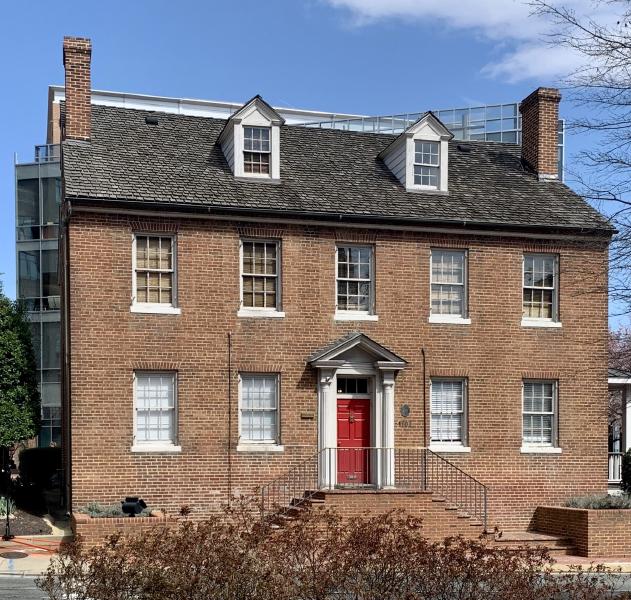
Theodore Christopher · via Wikimedia Commons · CC0 1315 Duke Street
Federal-style brick house at 1315 Duke Street built in the 1810s by Brigadier General Robert Young of the DC Militia; from 1828 to 1837 the …
Now
No current occupant on file. Are you, or someone you know, the present occupant? Claim this place to add operating hours, a current photo, and a short note.
Wilkes Street
Named for John Wilkes — English politician and Patriot ally, c. 1796.
Interpretive signs nearby
The City of Alexandria has installed 4 historical interpretive signs within walking distance of this place. Each link below opens the sign's page on this site, with the full image and trail context.
Civil Rights - African American Heritage Park
600 Holland Lane
Remembrance - African American Heritage Park
600 Holland Lane
Hooff's Run Bridge/Trail 1460 Duke St
Freedom - African American Heritage Park
600 Holland Lane
Sources
- 1.
National Archives and Records Administration, Union Provost Marshal records and Civil War-era military correspondence (RG 109, RG 110, RG 393).
Government record
- 2.
Wesley E. Pippenger, Alexandria, Virginia Death Records, 1863-1896, Heritage Books.
Book
See something wrong?
Every correction is logged dated to this page. Family history, old photographs, or a citation we missed — everything goes into the file.