

Strand Street
a.k.a. Strand Street
The Potomac waterfront from the Torpedo Factory south to Jones Point, subject to a decades-long redevelopment project that has converted former industrial and shipping frontage to parks, trails, and mixed-use buildings.
- 1975approx
- Extant
Place narrative
The Alexandria waterfront had been an industrial and shipping edge from the colonial period through the mid-twentieth century. Its features included the tide lock at the southern end of the 1 Wilkes Street 1 Wilkes Street The 1843 stone tide lock at the southern terminus of the Alexandria Canal, which connected the Chesapeake & Ohio Canal at Georgetown with the Alexandria waterfront via a seven-mile … , the Torpedo Factory complex ( 105 North Union Street 105 North Union Street Waterfront munitions plant built in 1918 as the U.S. Naval Torpedo Station; produced torpedoes through World War II, served as federal records storage after the war, and has … ), shipbuilding yards, fuel depots, and — beginning in the 1950s — the South Union Street South Union Street Complex of converted warehouse buildings along South Union Street used by Interarms from the late 1950s to the late 1990s to store surplus military small arms. At peak the complex … [1] HABS Alexandria survey Government record .
Beginning in the 1970s the City of Alexandria and a succession of private developers pursued a long-running, often-contentious redevelopment of the waterfront. The City’s 1974 acquisition of the Torpedo Factory and its 1980s Wales Alley and Founder’s Park projects reshaped the northern waterfront into a public-facing district of galleries and parks. The Robinson Terminal complexes — former newsprint warehouses serving the Washington Post — were redeveloped into mixed-use buildings in the 2010s and 2020s [2] Alexandria Library Special Collections Manuscript . The redevelopment has proceeded against the backdrop of recurring tidal flooding, archaeological discoveries, and public debate over density and access.
A continuous public waterfront walk now runs from the Torpedo Factory south to Waterfront Park and, intermittently, beyond to Jones Point. The walk’s completion sits in tension with ongoing questions about sea-level rise and the long-term viability of low-lying Potomac frontage [3] LOC Prints & Photographs Photograph .
Timeline
3 chronological entries across 3 eras.
- –
Interarms's South Union Street warehouses occupied a several-block stretch of the waterfront for four decades. [1] Source Brogan & Zarca, Deadly Business, 1983
Torpedo Factory redevelopment launches waterfront planning era [2] Source Alexandria Library Special Collections
City Council adopts Waterfront Small Area Plan [2] Source Alexandria Library Special Collections
Gallery
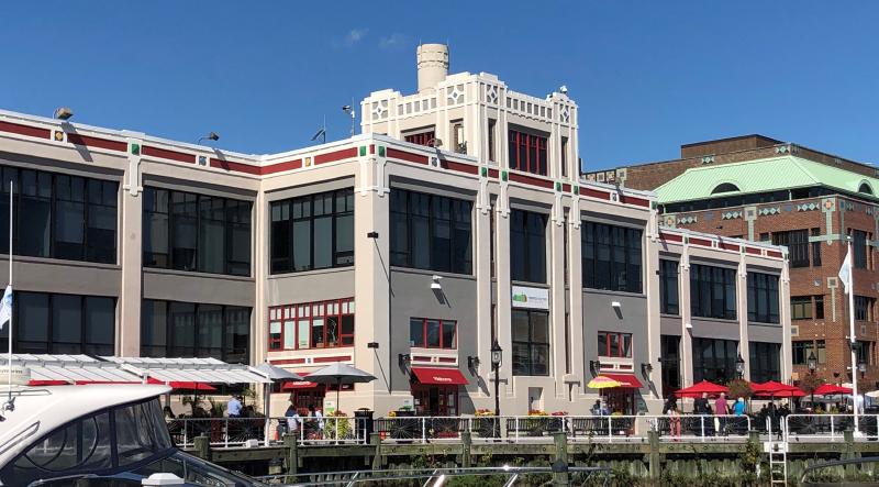
Placeholder illustration of Alexandria Waterfront. Seed placeholder — KingSt.com, 2026. To be replaced with archival photograph. 
Secondary placeholder view of Alexandria Waterfront. Seed placeholder — KingSt.com, 2026. To be replaced with archival photograph.
Connected
Interarms
founded 1953· dissolved 1999
Alexandria-based arms dealership founded by Samuel Cummings in 1953, doing business as Interarms. For much of the Cold War the firm held one of the largest private inventories of …
Operator · Warehouse · %!d(float64=1958)–%!d(float64=1999)
Nearby in time
9000 Richmond Highway 9000 Richmond Highway
Federal-style brick mansion built 1800–1805 by and on a 2,000-acre tract carved from the Mount Vernon estate as their wedding gift from .
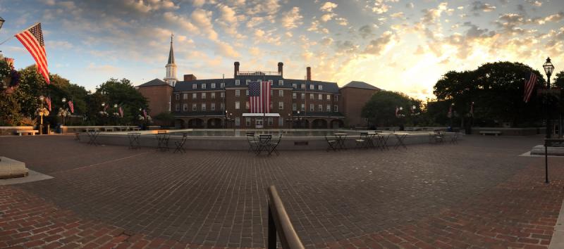
Market Square at sunrise, July 2017 — the city's eighteenth-century public square in its weekday-morning calm, framed by City Hall and the Fourth-of-July flags hung along the lamp posts. © KingSt.com, July 2017 301 King Street
Public square at 301 King Street fronting Alexandria City Hall — site of an open-air farmers market continuously operated since 1753, the …
530 South St. Asaph Street 530 South St. Asaph Street
Continuously operating school site on South St. Asaph Street whose institutional lineage runs from the city's segregated Black schools of …
1100 Wilkes Street 1100 Wilkes Street
Cluster of twelve adjacent burial grounds stretching across the 1100 block of Wilkes Street, including Methodist Protestant, Presbyterian, …
Nearby in space
Beyond My Ken · via Wikimedia Commons · CC BY-SA 4.0 105 North Union Street
Waterfront munitions plant built in 1918 as the U.S. Naval Torpedo Station; produced torpedoes through World War II, served as federal …
Placeholder illustration of Interarms Hq 10 Prince Street. Seed placeholder — KingSt.com, 2026. To be replaced with archival photograph. 10 Prince Street
Former office of International Armament Corporation (Interarms) at the foot of Prince Street; administrative headquarters of Samuel …
AgnosticPreachersKid at en.wikipedia · via Wikimedia Commons · CC BY-SA 3.0 201 Prince Street
Late-19th-century commercial building at the corner of Prince and Lee streets, an early local example of small-town bank architecture. …
201 Prince Street 201 Prince Street
Greek Revival temple-front building completed 1851 at 201 Prince Street as the Bank of the Old Dominion. Used during the Civil War as a …
Now
No current occupant on file. Are you, or someone you know, the present occupant? Claim this place to add operating hours, a current photo, and a short note.
Interpretive signs nearby
The City of Alexandria has installed 13 historical interpretive signs within walking distance of this place. Each link below opens the sign's page on this site, with the full image and trail context.
6 King St
103 N Union St
Waterfront Park near water facing to The Strand
Waterfront Park near water, facing up King Street
100 King St
Alexandria: A Place Through Time
on wall in breezeway
African American Heritage Waterfront Trail Orientation Sign
3rd Floor Torpedo Factory
105 N. Union Street, outside Suite 327
George Henry, Enslaved Ship Captain
Waterfront Park
105 N Union
Waterfront Park
Foot of Cameron Street
132 King St
Sources
- 1.
Historic American Buildings Survey, Alexandria, Virginia records, National Park Service / Library of Congress.
Government record
- 2.
Alexandria Library, Local History/Special Collections, Barrett Branch, Alexandria, Virginia.
Manuscript
- 3.
Library of Congress, Prints & Photographs Online Catalog (Washington: Library of Congress).
Photograph
See something wrong?
Every correction is logged dated to this page. Family history, old photographs, or a citation we missed — everything goes into the file.