
201
Prince Street
Greek Revival temple-front building completed 1851 at 201 Prince Street as the Bank of the Old Dominion. Used during the Civil War as a Union commissary, later a church, and since 1964 the home of the Northern Virginia Fine Arts Association as The Athenaeum art gallery.
- 1851
- Greek Revival
- Extant
- National Register of Historic PlacesVirginia Landmarks Register
Place narrative
The Athenaeum stands at 201 Prince Street, on the corner of Prince and South Lee, two blocks west of the Alexandria waterfront. The building was completed in 1851 as the Bank of the Old Dominion, designed in the Greek Revival temple-front vocabulary that defined antebellum American institutional architecture: a four-column Doric portico fronting a rectangular masonry shell, the whole rendered in stuccoed brick painted white.
During the Civil War, the bank closed and the building was pressed into service as a U.S. Army commissary depot under the Union occupation of Alexandria — one of dozens of civilian buildings the Union army requisitioned during the city’s 1861–65 occupation. After the war the structure served briefly as the Free Methodist Church and later as a wholesale druggist’s warehouse.
In 1964 the building was acquired by the Northern Virginia Fine Arts Association, who renamed it The Athenaeum — invoking the classical-Greek term for an institution of literary and artistic culture — and converted the interior into an art gallery. The Athenaeum has operated continuously as a gallery since, hosting rotating exhibits of contemporary art alongside public programs in the building’s Greek Revival main hall.
Timeline
No occupancies or events recorded yet for this place. Contribute a record →
The building
- Greek Revival
No images yet — contribute a photo.
Nearby in time
609 Oronoco Street 609 Oronoco Street
Federal-style brick house at 609 Oronoco Street where Quaker educator ran a boys' classical school from 1824. received his pre–West Point …
Richmond Highway Richmond Highway
~8,656-acre U.S. Army installation along Richmond Highway in Fairfax County, established 1917 as Camp A.A. Humphreys, renamed Fort Humphreys …
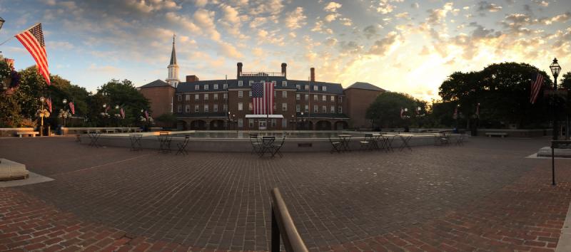
Market Square at sunrise, July 2017 — the city's eighteenth-century public square in its weekday-morning calm, framed by City Hall and the Fourth-of-July flags hung along the lamp posts. © KingSt.com, July 2017 301 King Street
Public square at 301 King Street fronting Alexandria City Hall — site of an open-air farmers market continuously operated since 1753, the …
107 South Alfred Street 107 South Alfred Street
1855 Italianate firehouse at 107 South Alfred Street, home of the Friendship Fire Company — founded 1774, the oldest volunteer fire company …
Nearby in space
Placeholder illustration of Interarms Hq 10 Prince Street. Seed placeholder — KingSt.com, 2026. To be replaced with archival photograph. 10 Prince Street
Former office of International Armament Corporation (Interarms) at the foot of Prince Street; administrative headquarters of Samuel …
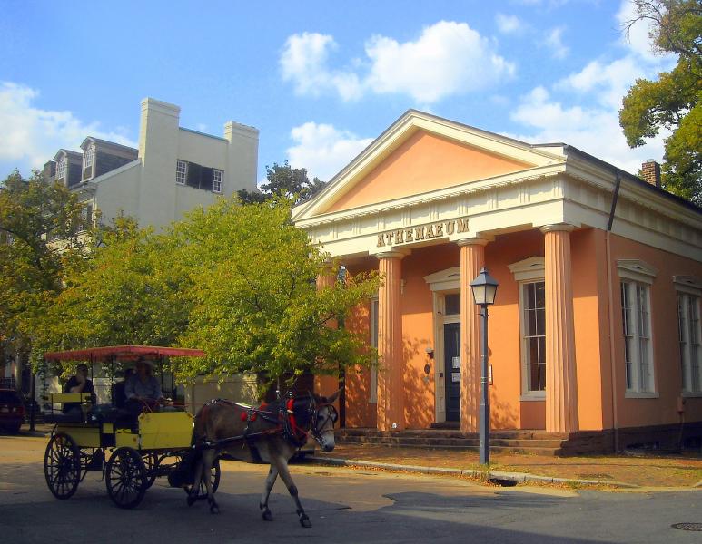
AgnosticPreachersKid at en.wikipedia · via Wikimedia Commons · CC BY-SA 3.0 201 Prince Street
Late-19th-century commercial building at the corner of Prince and Lee streets, an early local example of small-town bank architecture. …
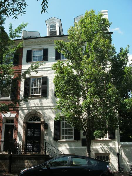
Ser Amantio di Nicolao at en.wikipedia · via Wikimedia Commons · CC BY 3.0 207 Prince Street
Brick townhouse built ca. 1763 in the colonial heart of Alexandria. NRHP-listed 1991.
Ben Schumin · via Wikimedia Commons · CC BY-SA 3.0 Strand Street
The Potomac waterfront from the Torpedo Factory south to Jones Point, subject to a decades-long redevelopment project that has converted …
Now
No current occupant on file. Are you, or someone you know, the present occupant? Claim this place to add operating hours, a current photo, and a short note.
Prince Street
Named for The Prince of Wales (Frederick, then his son George, later King George III), c. 1749.
Interpretive signs nearby
The City of Alexandria has installed 3 historical interpretive signs within walking distance of this place. Each link below opens the sign's page on this site, with the full image and trail context.
Industrialization of The Strand
211 Strand
211 Strand
Foot of Duke Street
See something wrong?
Every correction is logged dated to this page. Family history, old photographs, or a citation we missed — everything goes into the file.