
4301
West Braddock Road
Earthwork fort raised in 1861 as part of the ring of Union fortifications around Washington; the fifth-largest of the Civil War defenses of the capital. After the war the fort’s grounds became the site of a freedmen’s community known as The Fort.
- 1861
- Earthwork
- Extant
- National Register of Historic Places
Place narrative
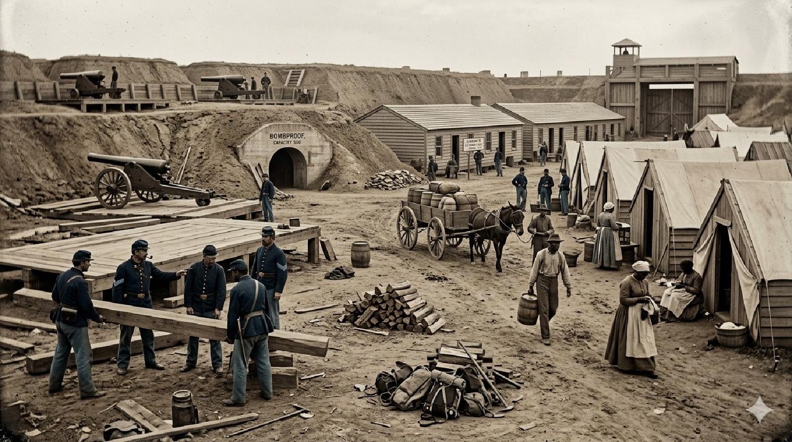
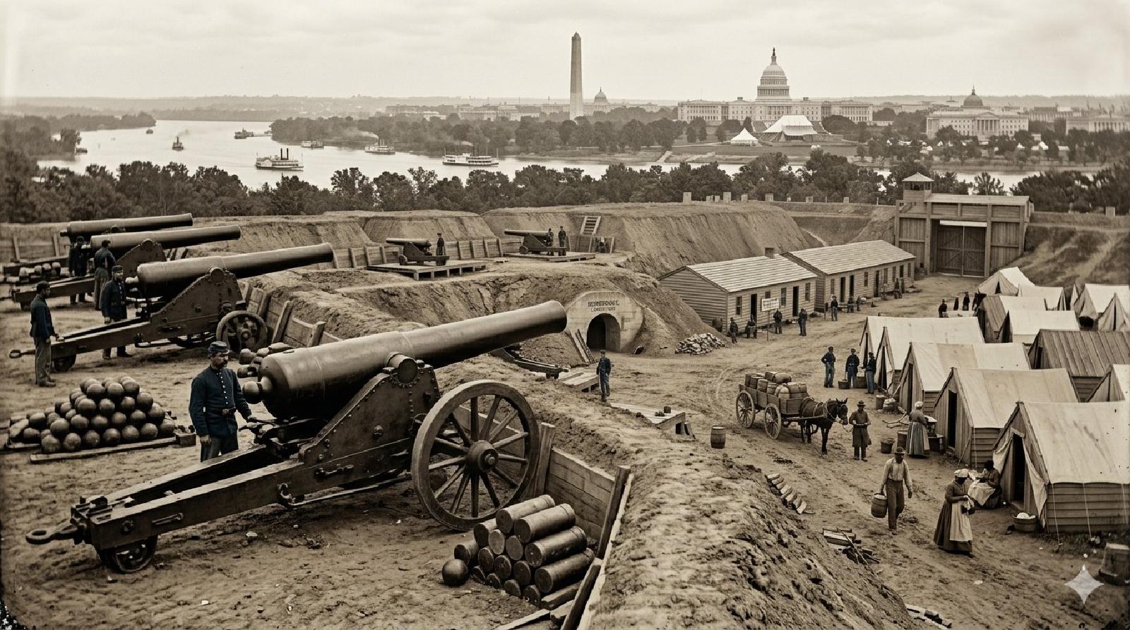
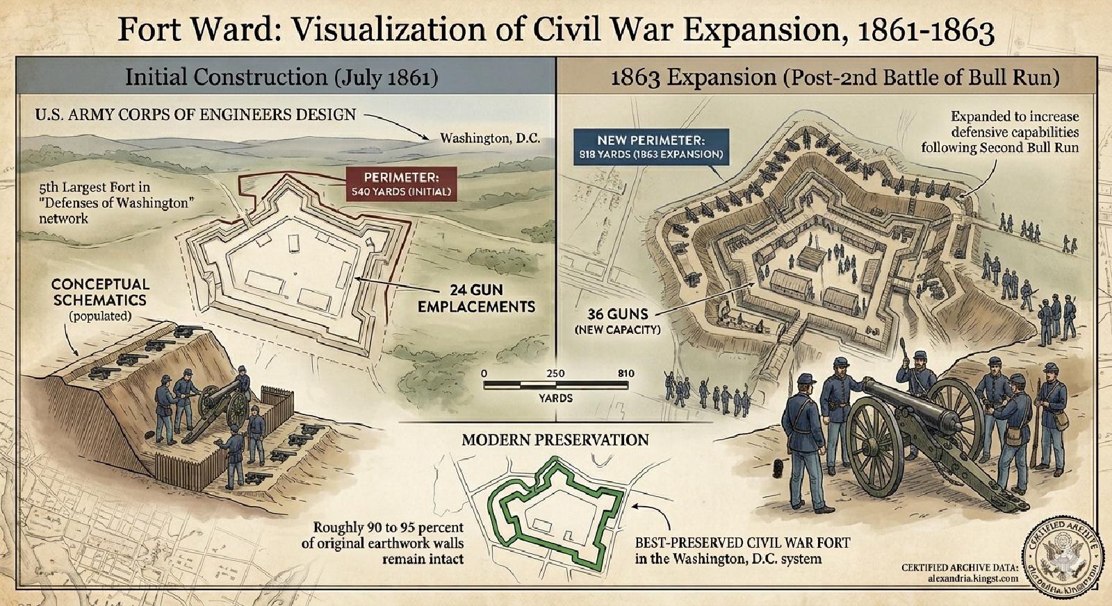
Fort Ward was constructed starting in September 1861 under the supervision of the Army Corps of Engineers as one of sixty-eight enclosed forts encircling Washington — the fifth-largest of the ring. Sited on high ground in what was then the northwest of Alexandria County, the fort was originally laid out with a 540-yard perimeter and platforms for 24 guns (a 100-pounder Parrott rifle was added later); in 1863 the perimeter was expanded to 818 yards with capacity for 36 guns commanding the Leesburg Turnpike and the approaches to the city [1] NARA Civil War records Government record [2] Richard Wright, "From Days Gone By" Facebook post on Fort Ward Oral history . Construction and the flow of men and materials south of Four Mile Run were supervised by General John Newton. Self-emancipated and recently freed Black workers — called “contrabands” in wartime usage — supplied much of the labor that built the ring of forts around Washington, including Fort Ward. The fort was named for Commander James H. Ward, the first Union naval officer killed in the war.
The 1st Connecticut Heavy Artillery
The 1st Connecticut Heavy Artillery Regiment was organized from the former 4th Connecticut Volunteer Infantry on January 2, 1862, in Washington, DC. A typical regiment was divided into ten companies of roughly one hundred soldiers apiece, trained in the use of artillery. The 1st Connecticut helped defend the Union capital until April 1862, when it joined General McClellan’s Army of the Potomac for the Peninsula Campaign. The regiment was involved in siege operations around Yorktown from April 12 to May 4, and then in what became known as the Seven Days Battles against Robert E. Lee’s Army of Northern Virginia — the “Heavies,” as Bruce Catton called the Heavy Artillery regiments in A Stillness at Appomattox, fought at Gaines’ Mill on June 27 and Malvern Hill on July 1. After McClellan’s retreat from the peninsula, the Heavies returned to the defenses of Washington. Companies C, E, and L of the 1st Battalion were stationed at Fort Ward in 1863 [3] Wikipedia, "1st Connecticut Heavy Artillery Regiment" Website [4] Bruce Catton, "A Stillness at Appomattox" (1953) Book [2] Richard Wright, "From Days Gone By" Facebook post on Fort Ward Oral history .
Postwar: dismantlement and the freedmen community
The fort was dismantled in November 1865, and the land passed into private hands — though, remarkably, more than 90 percent of the original earthen works are still intact today. Beginning in the late 1860s, a community of formerly enslaved people and their descendants settled on and around the former fort grounds, drawn by the availability of inexpensive land. The community, which residents called simply “The Fort” or “Fort Ward,” included a church, a school, and a burying ground, and persisted as an identifiable neighborhood well into the 1960s, when midcentury urban renewal and the expansion of the adjacent cemetery displaced most of the remaining residents [5] Alexandria Library Special Collections Manuscript . Ongoing archaeological work on the site has documented dwellings, wells, and burial features associated with the Fort Ward community.
The City of Alexandria acquired the site in 1961, partially reconstructed the earthworks for the Civil War centennial, and opened Fort Ward Park and Museum. The museum’s exhibits address both the military history of the fort and the African American community that followed it; the freedmen’s community is represented by the collective entity Freedmen of the Contrabands Camp Freedmen of the Contrabands Camp founded 1861 Collective entity representing the several thousand formerly enslaved people who fled to Union-occupied Alexandria during the Civil War, settling in camps at Shuter's Hill, around … [6] LOC Prints & Photographs Photograph .
Timeline
9 chronological entries across 3 eras.
- –
Escapees from slavery settled in camps around the fort during its wartime operation. [1] Source NARA Civil War records
Construction of Fort Ward [1] Source NARA Civil War records
Fort Ward expanded to 818-yard perimeter, 36 guns [2] Source Richard Wright, "From Days Gone By" Facebook post on Fort Ward
1st Connecticut Heavy Artillery, Companies C, E, and L stationed at Fort Ward [3] Source Wikipedia, "1st Connecticut Heavy Artillery Regiment" [2] Source Richard Wright, "From Days Gone By" Facebook post on Fort Ward
- –
Formerly enslaved people and their descendants settled on and around the fort grounds after the war, forming a community known as The Fort that persisted for nearly a century. [4] Source Alexandria Library Special Collections [1] Source NARA Civil War records
Abandonment and dismantlement [1] Source NARA Civil War records
Abandonment and dismantlement, November 1865 [1] Source NARA Civil War records [2] Source Richard Wright, "From Days Gone By" Facebook post on Fort Ward
- –
The Fort Ward community maintained its own burial ground; archaeological work has documented burial features on the site. [4] Source Alexandria Library Special Collections
Acquisition as Fort Ward Park [4] Source Alexandria Library Special Collections
The building
- Earthwork
Gallery
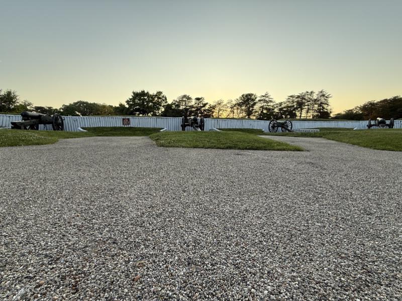
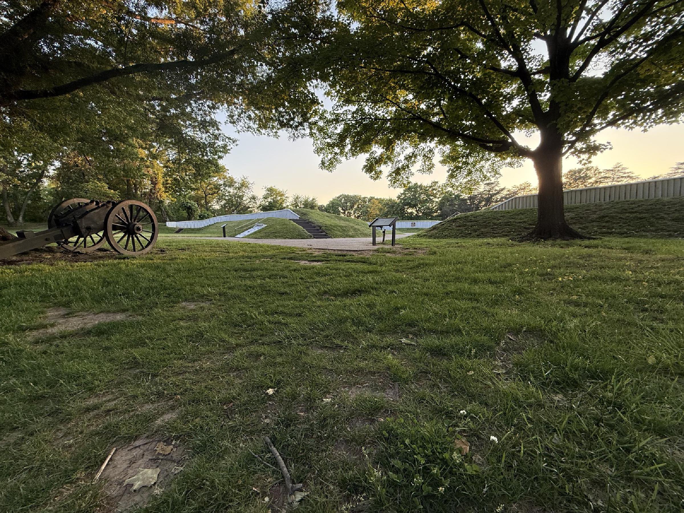
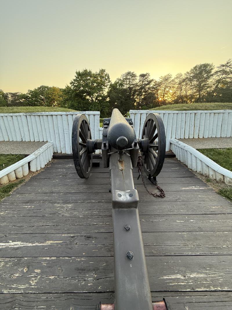
Reconstructed gun emplacement at Fort Ward — May 9, 2026. © KingSt.com, May 2026 site visit 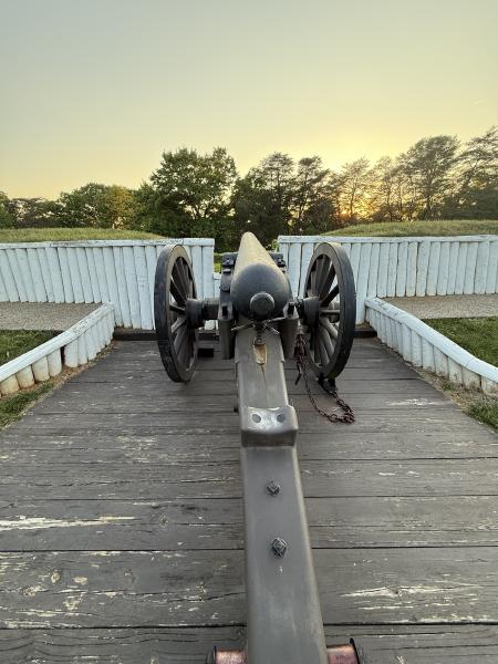
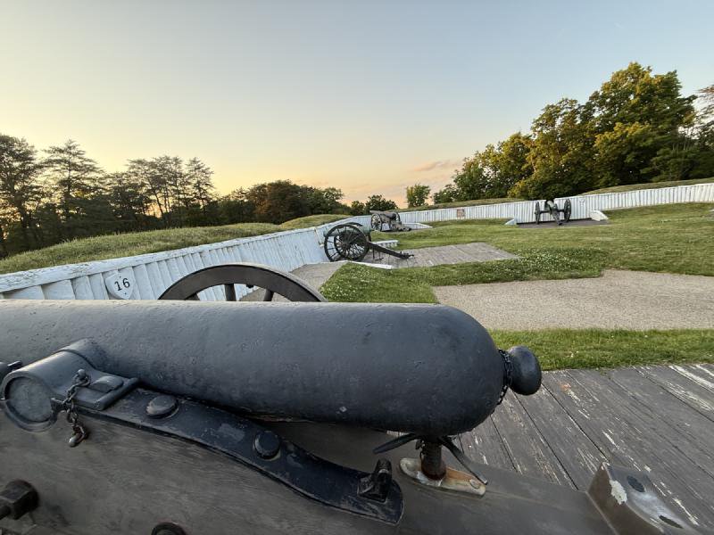
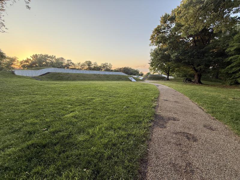
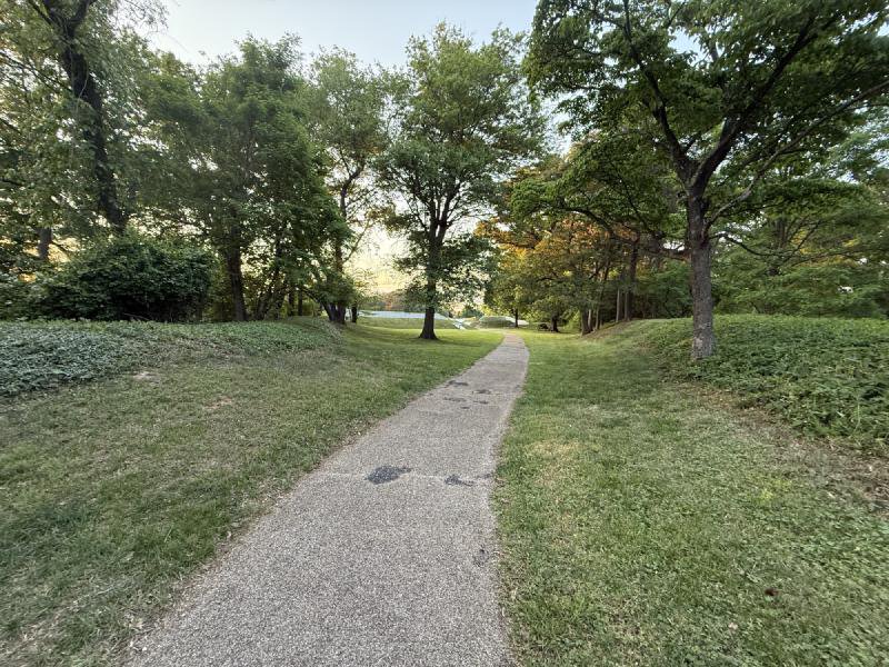
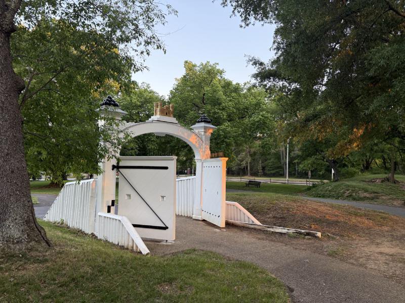
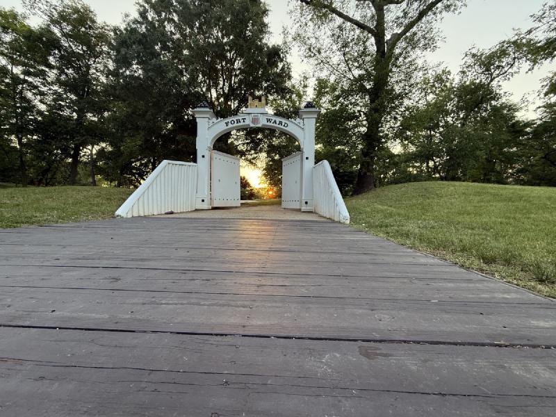
Fort Ward Park, Alexandria — May 9, 2026. © KingSt.com, May 2026 site visit 
Fort Ward Park, Alexandria — May 9, 2026. © KingSt.com, May 2026 site visit 
Fort Ward Park, Alexandria — May 9, 2026. © KingSt.com, May 2026 site visit 
Fort Ward Park, Alexandria — May 9, 2026. © KingSt.com, May 2026 site visit 
Fort Ward Park, Alexandria — May 9, 2026. © KingSt.com, May 2026 site visit 
Fort Ward Park, Alexandria — May 9, 2026. © KingSt.com, May 2026 site visit 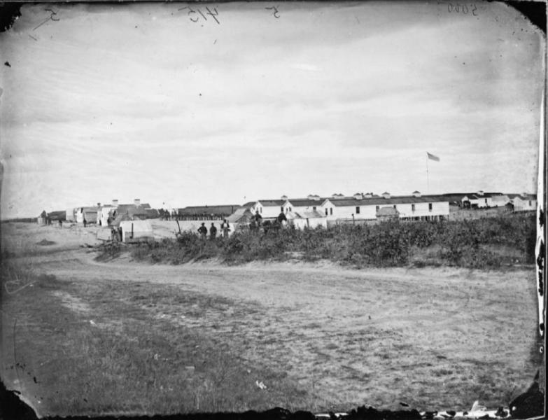
Fort Ward in 1863 — barracks of the 1st Battalion, Companies C, E, and L of the 1st Connecticut Heavy Artillery, then garrisoning the fort as part of the Civil War defensive ring around Washington. Civil War-era photograph of Fort Ward barracks, 1863 (public domain by age) 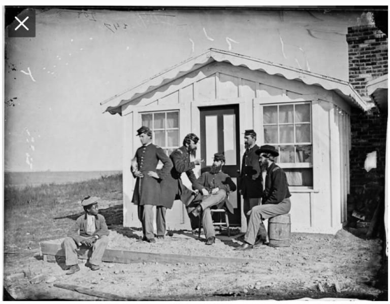
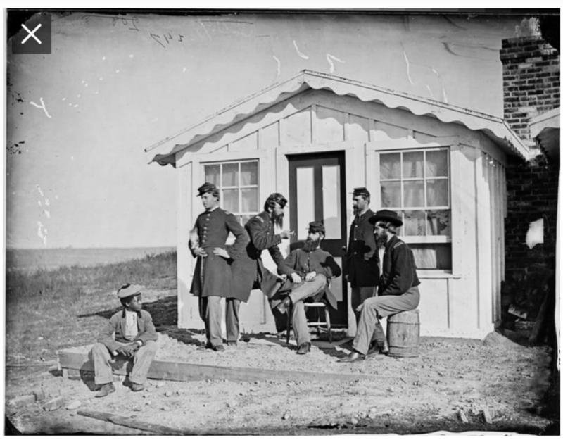
Officers of the 1st Connecticut Heavy Artillery outside the Officers Hut at Fort Ward, c. 1863. The unnamed Black boy seated at left was likely from the freedmen's encampment that grew up around the fort during the war. Civil War-era photograph, Officers Hut at Fort Ward (public domain by age) 
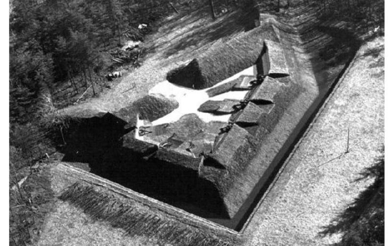
Undated aerial photograph of the reconstructed Fort Ward earthwork. The fifth-largest of the sixty-eight forts in the Civil War defenses of Washington, Fort Ward retains more than 90 percent of its original earthen works. Undated aerial photograph of reconstructed Fort Ward — From Days Gone By, City of Alexandria (fair use)


Virtual Reconstruction
The images below are AI-generated visual reconstructions, not historical photographs. They were produced with generative AI models to illustrate dimensions, garrison life, and landscape context documented in the sources cited elsewhere on this page. Treat them as conjectural illustrations grounded in evidence, not as evidence themselves.
Connected
Freedmen of the Contrabands Camp
founded 1861
Collective entity representing the several thousand formerly enslaved people who fled to Union-occupied Alexandria during the Civil War, settling in camps at Shuter's Hill, around …
Resident · Contraband camp · %!d(float64=1861)–%!d(float64=1865)
Nearby in time
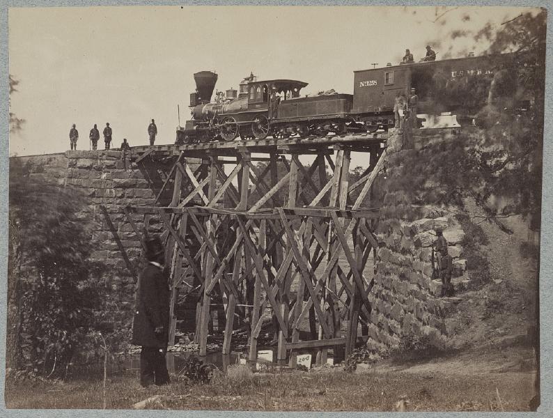
Bridge on Orange & Alexandria Railroad · Library of Congress, Prints & Photographs Division · http://www.loc.gov/item/2012649966/ Jamieson Avenue at Hooff's Run
1851 stone arch railroad bridge, in continuous use since the eve of the Civil War. NRHP-listed 2003.
Placeholder illustration of Louverture Hospital Site. Seed placeholder — KingSt.com, 2026. To be replaced with archival photograph. 219 South Payne Street
Union Army hospital established in February 1864 for U.S. Colored Troops and Black civilian refugees in occupied Alexandria. Named for …
Placeholder illustration of Alexandria National Cemetery. Seed placeholder — KingSt.com, 2026. To be replaced with archival photograph. 1450 Wilkes Street
One of the original fourteen national cemeteries established in 1862, interring Union dead from the Civil War, including United States …
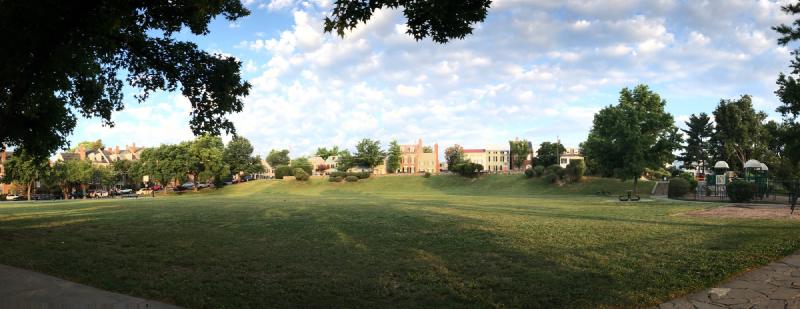
Windmill Hill Park at sunrise, July 2017 — the open grass meadow that once held Robert Townshend Hooe's c. 1791 grain windmill, with the Old Town row houses of South Union Street rising on the inland side and the playground visible at right. © KingSt.com, July 2017 501 South Union Street
Six-acre city park at 501 South Union Street, occupying the south Old Town waterfront hill that gave its name first to a c. 1791 wind-driven …
Nearby in space
4195 West Braddock Road 4195 West Braddock Road
African-American cemetery established 1885 on land adjacent to Fort Ward, used by descendants of the freedmen's community known as The Fort. …
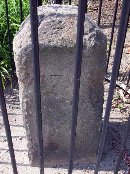
Bruce Andersen from Washington, DC · via Wikimedia Commons · CC BY-SA 2.0 King Street
Fourth of the original DC southwestern boundary stones; the marker straddles the Alexandria-Arlington line. NRHP-listed 1991.
1000 Saint Stephens Road 1000 Saint Stephens Road
Upper School (grades 9–12) of St. Stephen's & St. Agnes School, occupying the Saint Stephens Road campus opened in January 1957 by St. …
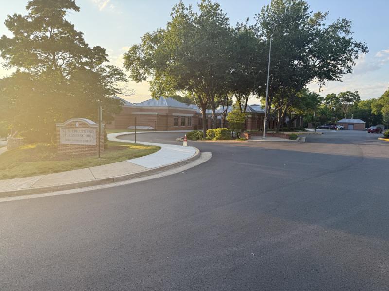
St. Stephen's and St. Agnes Middle School Campus on West Braddock Road at sunrise — the entrance sign and the brick academic buildings beyond, back-lit by golden-hour light. © KingSt.com, 2024 4401 West Braddock Road
Middle School (grades 6–8) of St. Stephen's & St. Agnes since the late 1990s, on the West Braddock Road campus that previously housed …
Now
No current occupant on file. Are you, or someone you know, the present occupant? Claim this place to add operating hours, a current photo, and a short note.
Braddock Road
Named for General Edward Braddock — British commander killed at the Monongahela, 1755, c. 1755.
Interpretive signs nearby
The City of Alexandria has installed 11 historical interpretive signs within walking distance of this place. Each link below opens the sign's page on this site, with the full image and trail context.
African Americans and the Civil War - Fleeing, Fighting and Working for Freedom
Fort Ward Park 4301 W Braddock Rd
Fort Ward Park 4301 W Braddock Rd
"The Fort" and "Seminary" Community Civil War to Civil Rights
Fort Ward Park 4301 W Braddock Rd
Fort Ward Park 4301 W Braddock Rd
Fort Ward Park 4301 W Braddock Rd
Within Its Walls - A Foundation for Education and Opportunity
Fort Ward Park 4301 W Braddock Rd
Oakland Baptist Church Cemetery
Fort Ward Park 4301 W Braddock Rd
Fort Ward Park 4301 W Braddock Rd
Fort Ward Park 4301 W Braddock Rd
Fort Ward Park 4301 W Braddock Rd
Video tour

Fort Ward Museum
Gimbal walking tour of the Fort Ward Museum interior.
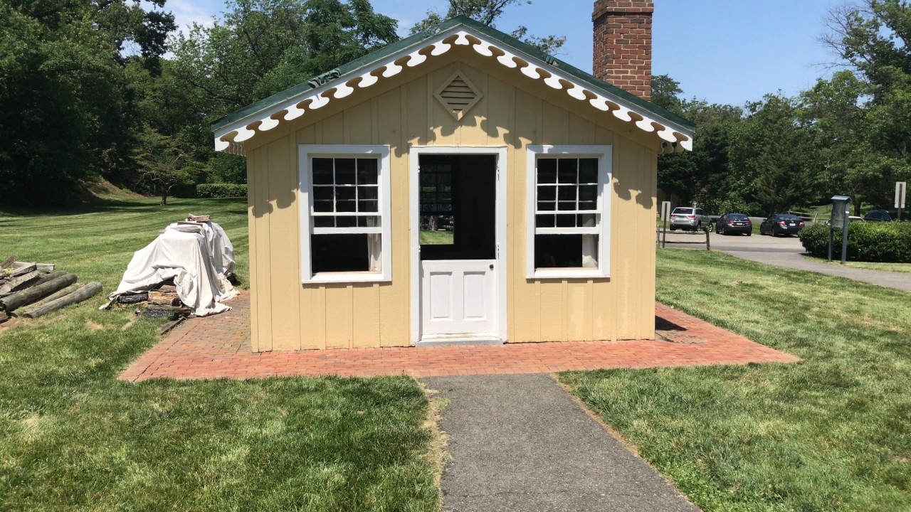
The Cabin
Gimbal tour of the reconstructed officers' cabin at Fort Ward.

Civil War Camp Day, 2017
Reenactment footage from Fort Ward Park's Civil War Camp Day, 2017.

C-SPAN Cities Tour: History of Fort Ward
C-SPAN's Cities Tour feature on the history of Fort Ward, part of its Alexandria, Virginia segment.
Sources
- 1.
National Archives and Records Administration, Union Provost Marshal records and Civil War-era military correspondence (RG 109, RG 110, RG 393).
Government record
- 2.
Public Facebook reminiscence shared by Richard Wright (https://www.facebook.com/richard.wright.943687) in the "From Days Gone By" Alexandria local-history series, with an undated aerial photograph of the reconstructed Fort Ward and a descriptive caption attributed to City of Alexandria materials. Used here for the fort's original 540-yard perimeter and 24-gun platforms, the 1863 expansion to 818 yards and 36 guns, the "fifth-largest of sixty-eight forts" framing, General John Newton's supervision of forts south of Four Mile Run, the November 1865 dismantlement date, the "more than 90 percent of original earthen works intact" claim, and the contraband construction-labor note.
Oral history https://www.facebook.com/share/p/1FRwjcEmWc/ →
- 3.
Wikipedia contributors, "1st Connecticut Heavy Artillery Regiment," Wikipedia, The Free Encyclopedia, accessed 2026. Cites Connecticut Civil War service records and the regimental roster compiled by the Connecticut Adjutant General's office. Used here for the regiment's organization from the 4th Connecticut Volunteer Infantry on January 2, 1862; its role in McClellan's Peninsula Campaign; and the 1863 posting of the 1st Battalion Companies C, E, and L to Fort Ward.
Website https://en.wikipedia.org/wiki/1st_Connecticut_Heavy_Artillery_Regiment →
- 4.
Bruce Catton, "A Stillness at Appomattox," New York: Doubleday & Company, 1953. Third volume of the Army of the Potomac trilogy; winner of the Pulitzer Prize for History and the National Book Award. Used here for Catton's framing of the Heavy Artillery regiments — "the Heavies" — and the regimental arc of the 1st Connecticut Heavy Artillery through Gaines' Mill, Malvern Hill, and Appomattox.
Book
- 5.
Alexandria Library, Local History/Special Collections, Barrett Branch, Alexandria, Virginia.
Manuscript
- 6.
Library of Congress, Prints & Photographs Online Catalog (Washington: Library of Congress).
Photograph
See something wrong?
Every correction is logged dated to this page. Family history, old photographs, or a citation we missed — everything goes into the file.