
7
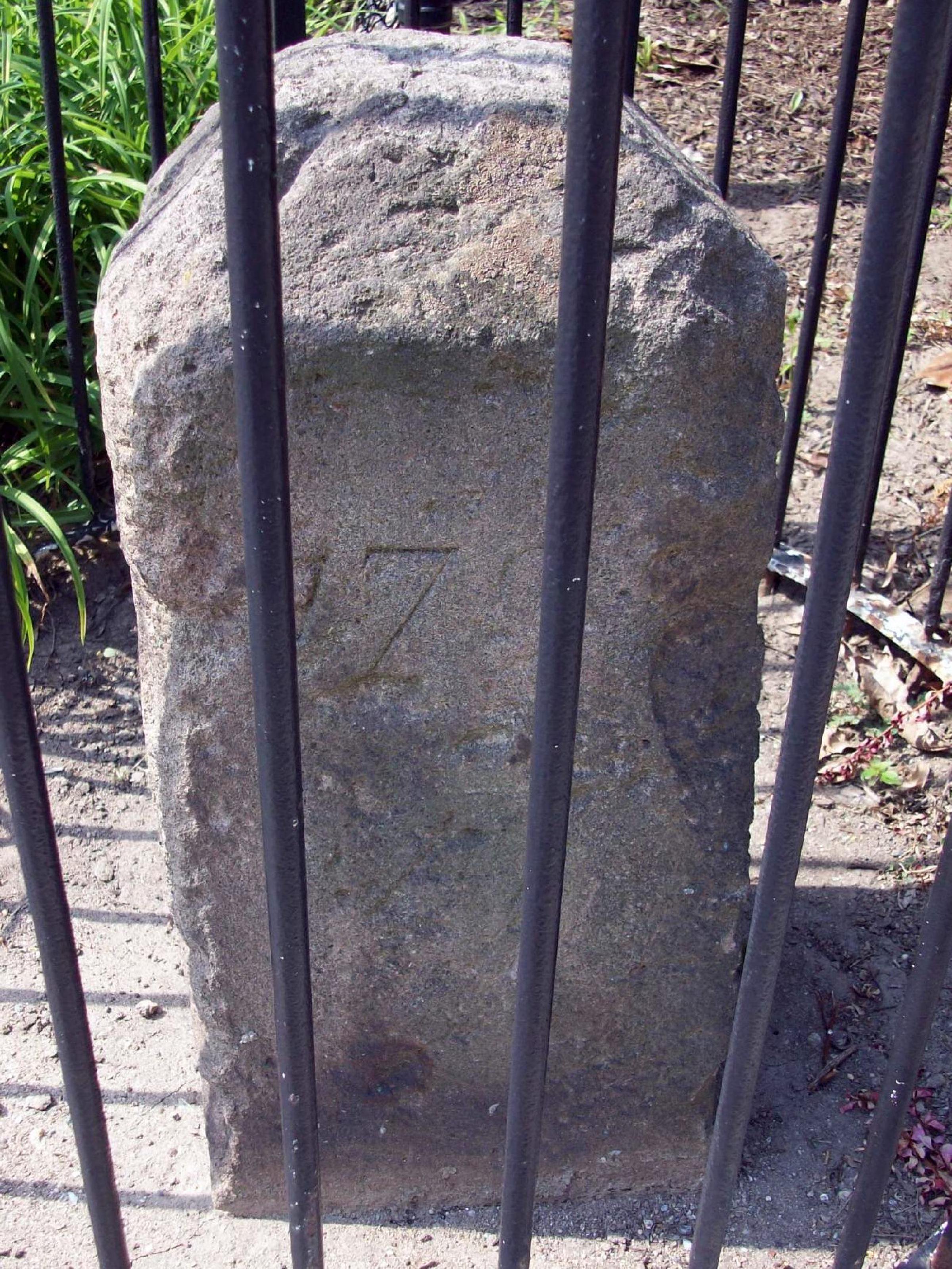
Russell Road
Second of the original DC southwestern boundary stones, placed 1791-1792. NRHP-listed 1991.
- Extant
- National Register of Historic Places
No images yet — contribute a photo.
Nearby in time
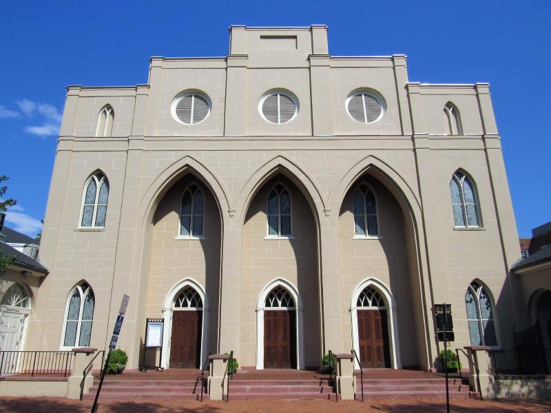
Farragutful · via Wikimedia Commons · CC BY-SA 4.0 228 South Pitt Street
Federal-Greek Revival 1817 sanctuary, the second oldest Episcopal congregation in Alexandria after Christ Church. NRHP-listed 1985.
9000 Richmond Highway 9000 Richmond Highway
Federal-style brick mansion built 1800–1805 by and on a 2,000-acre tract carved from the Mount Vernon estate as their wedding gift from .
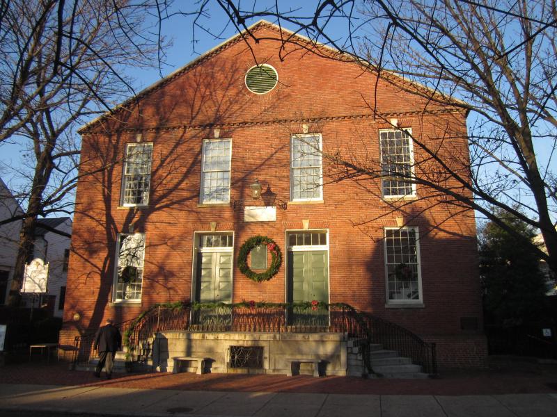
Doug Kerr from Albany, NY, United States · via Wikimedia Commons · CC BY-SA 2.0 321 South Fairfax Street
Brick Presbyterian meeting house begun in 1775; site of the city's memorial services for George Washington on December 29, 1799, four days …

Bruce Andersen from Washington, DC · via Wikimedia Commons · CC BY-SA 2.0 Fifth of the original DC southwestern boundary stones, near the Arlington line. NRHP-listed 1991.
Nearby in space
Beyond My Ken · via Wikimedia Commons · CC BY-SA 4.0 110 Callahan Drive
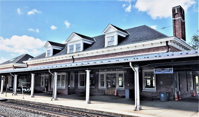
1905 railway terminal at the foot of King Street, currently serving Amtrak, VRE, and Washington Metro Blue/Yellow lines. NRHP-listed 2013.
Er1ckRailfan · via Wikimedia Commons · CC BY-SA 4.0 1900 King Street
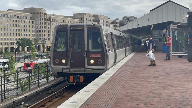
Washington Metro station opened December 1983 at the west end of King Street, catalyzing mixed-use redevelopment of the surrounding blocks …
Joe Ravi ( Shutterstock iStock Dreamstime ) · via Wikimedia Commons · CC BY-SA 3.0 101 Callahan Drive
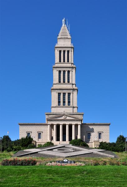
A 333-foot granite tower atop Shuter's Hill, completed 1932 by Freemasons across the United States to honor as Charter Master of . …
Streetcar-suburb residential neighborhood developed 1908 onward on the western edge of Alexandria, characterized by Colonial Revival and …
Now
No current occupant on file. Are you, or someone you know, the present occupant? Claim this place to add operating hours, a current photo, and a short note.
Russell Road
Named for A founding Del Ray-area landowner (further research needed), c. 1894.
Interpretive signs nearby
The City of Alexandria has installed 4 historical interpretive signs within walking distance of this place. Each link below opens the sign's page on this site, with the full image and trail context.
Callahan Drive at Amtrak Station
Amtrak Station 110 Callahan Dr
See something wrong?
Every correction is logged dated to this page. Family history, old photographs, or a citation we missed — everything goes into the file.