
King Street
a.k.a. King Street
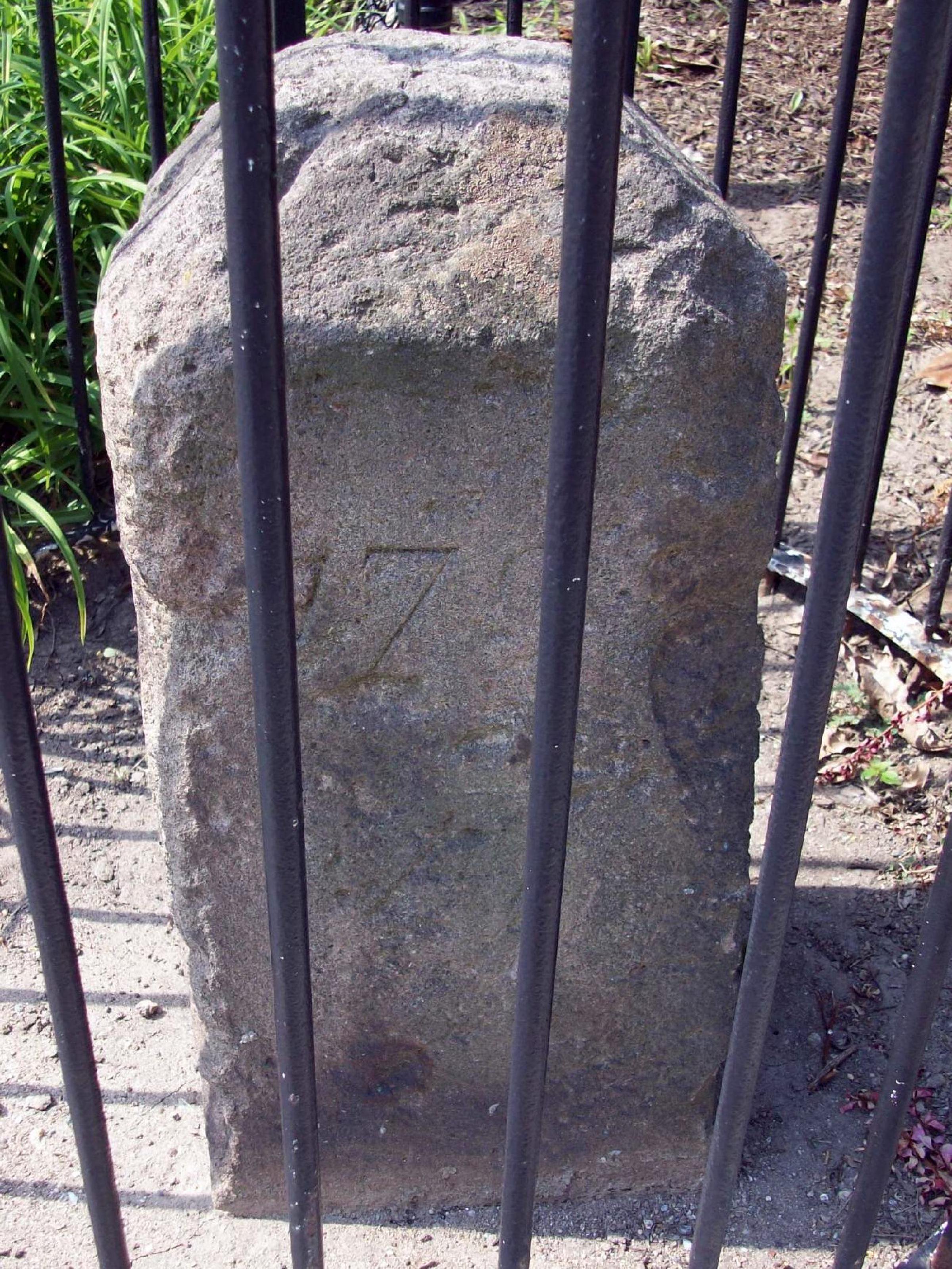
Fourth of the original DC southwestern boundary stones; the marker straddles the Alexandria-Arlington line. NRHP-listed 1991.
- Extant
- National Register of Historic Places
No images yet — contribute a photo.
Nearby in time
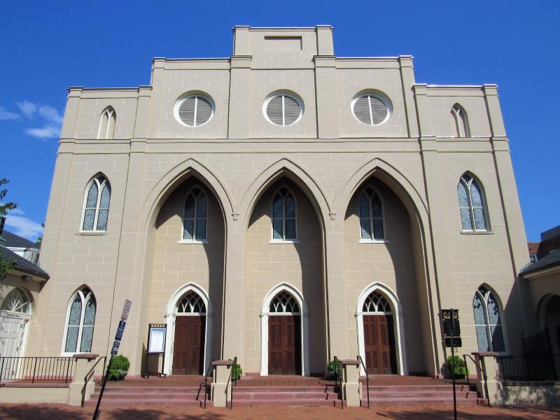
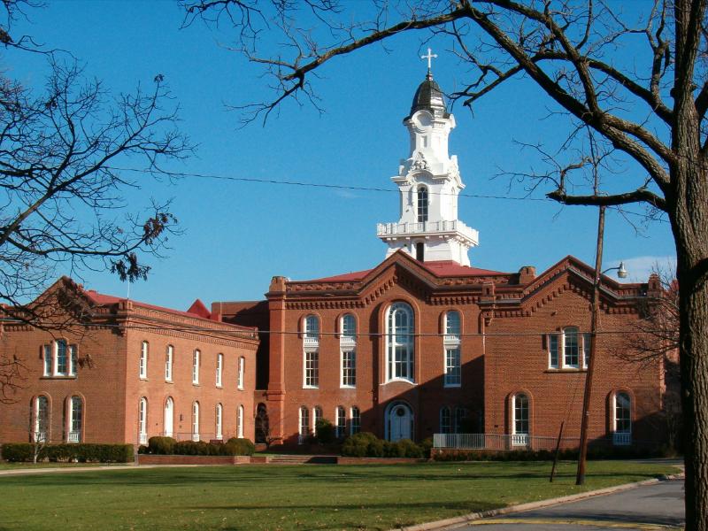
Farragutful · via Wikimedia Commons · CC BY-SA 4.0 228 South Pitt Street
Federal-Greek Revival 1817 sanctuary, the second oldest Episcopal congregation in Alexandria after Christ Church. NRHP-listed 1985.
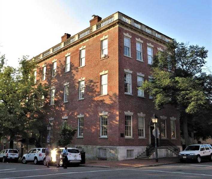
The 1807 Bank of Alexandria building at 133 N. Fairfax Street, Old Town Alexandria — the surviving Federal-style banking house after the late-1960s demolition of the Civil War-era hotel expansion. Photographed June 2014. Bank of Alexandria photographed by Ken Lund / Flickr, CC BY-SA 2.0 (2014) 133 North Fairfax Street
Federal-style 1807 banking house at the corner of North Fairfax and Cameron Streets — the surviving home of the Bank of Alexandria, …
The c. 1741 manor house of on the southern Northern Neck proprietary tract — social anchor of the colonial Fairfax–Washington circle, where …
614 Wolfe Street 614 Wolfe Street
Two-story brick schoolhouse built 1786 on Wolfe Street. was a founding trustee and bequeathed funds for free education of poor children. …
Nearby in space
400 Fontaine Street 400 Fontaine Street
Lower School (JK through grade 5) of St. Stephen's & St. Agnes School, on Fontaine Street in Seminary Hill. Originally a campus of St. Agnes …
4195 West Braddock Road 4195 West Braddock Road
African-American cemetery established 1885 on land adjacent to Fort Ward, used by descendants of the freedmen's community known as The Fort. …
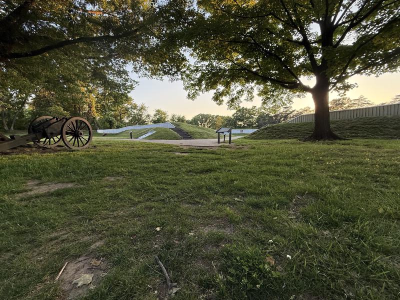
Restored Fort Ward earthwork, Seminary Hill, Alexandria — May 9, 2026. © KingSt.com, May 2026 site visit 4301 West Braddock Road
Earthwork fort raised in 1861 as part of the ring of Union fortifications around Washington; the fifth-largest of the Civil War defenses of …
John W. Cross · via Wikimedia Commons · CC BY 2.5 3737 Seminary Road
Episcopal theological seminary founded in Alexandria in 1823 and relocated to its present hilltop campus in 1827. Occupied by Union forces …
Now
No current occupant on file. Are you, or someone you know, the present occupant? Claim this place to add operating hours, a current photo, and a short note.
King Street
Named for King George II of Great Britain (reigning 1727-1760), c. 1749.
Interpretive signs nearby
The City of Alexandria has installed 1 historical interpretive sign within walking distance of this place. Each link below opens the sign's page on this site, with the full image and trail context.
See something wrong?
Every correction is logged dated to this page. Family history, old photographs, or a citation we missed — everything goes into the file.