
a.k.a. Sw No 5 Boundary Marker
Fifth of the original DC southwestern boundary stones, near the Arlington line. NRHP-listed 1991.
- Extant
- National Register of Historic Places
No images yet — contribute a photo.
Nearby in time
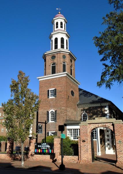
Beyond My Ken · via Wikimedia Commons · CC BY-SA 4.0 118 North Washington Street
Alexandria's Georgian-style Episcopal parish church, consecrated in 1773; pew owners included George Washington and, decades later, the Lee …
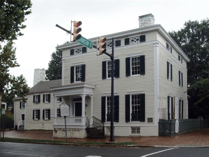
The original uploader was Ser Amantio di Nicolao at English Wikipedia . · via Wikimedia Commons · CC BY 3.0 614 Oronoco Street
Federal-style house built in 1785 by Philip Richard Fendall on land acquired from the Lee family. Occupied by a rotating cast of Lee family …
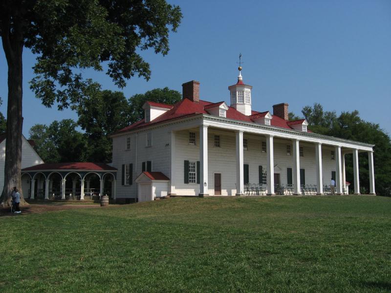
Ken Lund from Reno, Nevada, USA · via Wikimedia Commons · CC BY-SA 2.0 3200 Mount Vernon Memorial Highway
Five-farm plantation on the Potomac owned by George Washington from 1761 until his death in 1799; home to Washington, his family, and more …
The c. 1741 manor house of on the southern Northern Neck proprietary tract — social anchor of the colonial Fairfax–Washington circle, where …
Nearby in space
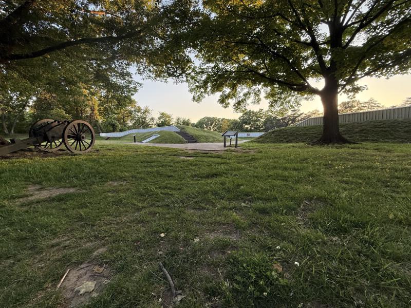
Restored Fort Ward earthwork, Seminary Hill, Alexandria — May 9, 2026. © KingSt.com, May 2026 site visit 4301 West Braddock Road
Earthwork fort raised in 1861 as part of the ring of Union fortifications around Washington; the fifth-largest of the Civil War defenses of …
4195 West Braddock Road 4195 West Braddock Road
African-American cemetery established 1885 on land adjacent to Fort Ward, used by descendants of the freedmen's community known as The Fort. …

Bruce Andersen from Washington, DC · via Wikimedia Commons · CC BY-SA 2.0 King Street
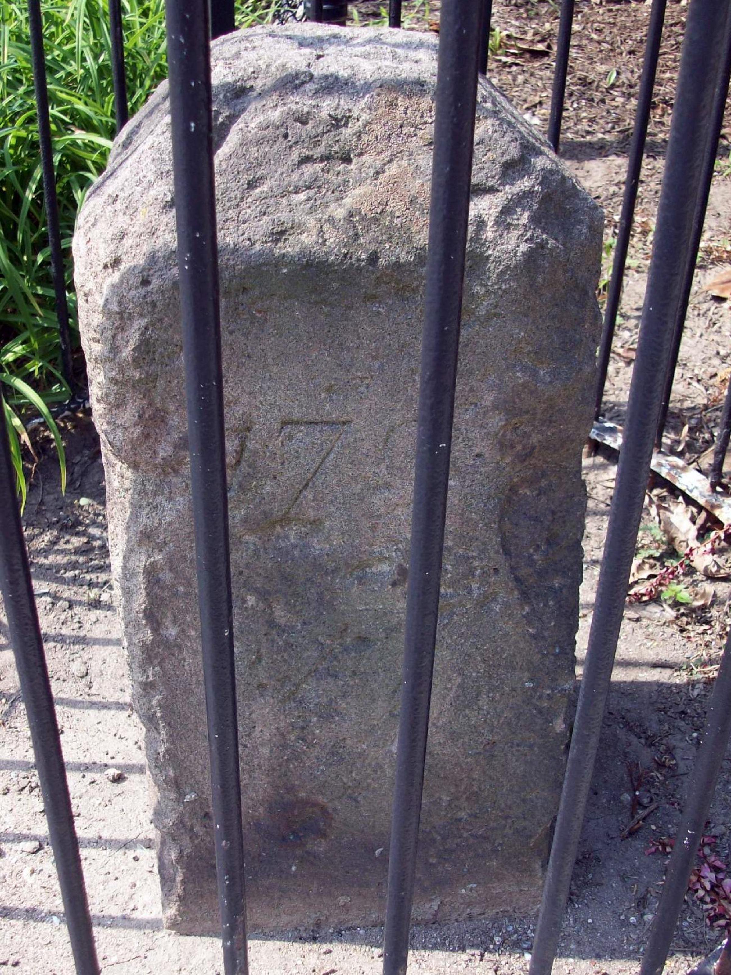
Fourth of the original DC southwestern boundary stones; the marker straddles the Alexandria-Arlington line. NRHP-listed 1991.
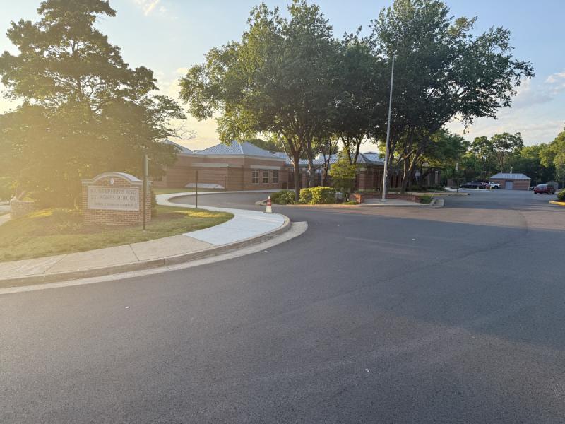
St. Stephen's and St. Agnes Middle School Campus on West Braddock Road at sunrise — the entrance sign and the brick academic buildings beyond, back-lit by golden-hour light. © KingSt.com, 2024 4401 West Braddock Road
Middle School (grades 6–8) of St. Stephen's & St. Agnes since the late 1990s, on the West Braddock Road campus that previously housed …
Now
No current occupant on file. Are you, or someone you know, the present occupant? Claim this place to add operating hours, a current photo, and a short note.
Interpretive signs nearby
The City of Alexandria has installed 1 historical interpretive sign within walking distance of this place. Each link below opens the sign's page on this site, with the full image and trail context.
See something wrong?
Every correction is logged dated to this page. Family history, old photographs, or a citation we missed — everything goes into the file.